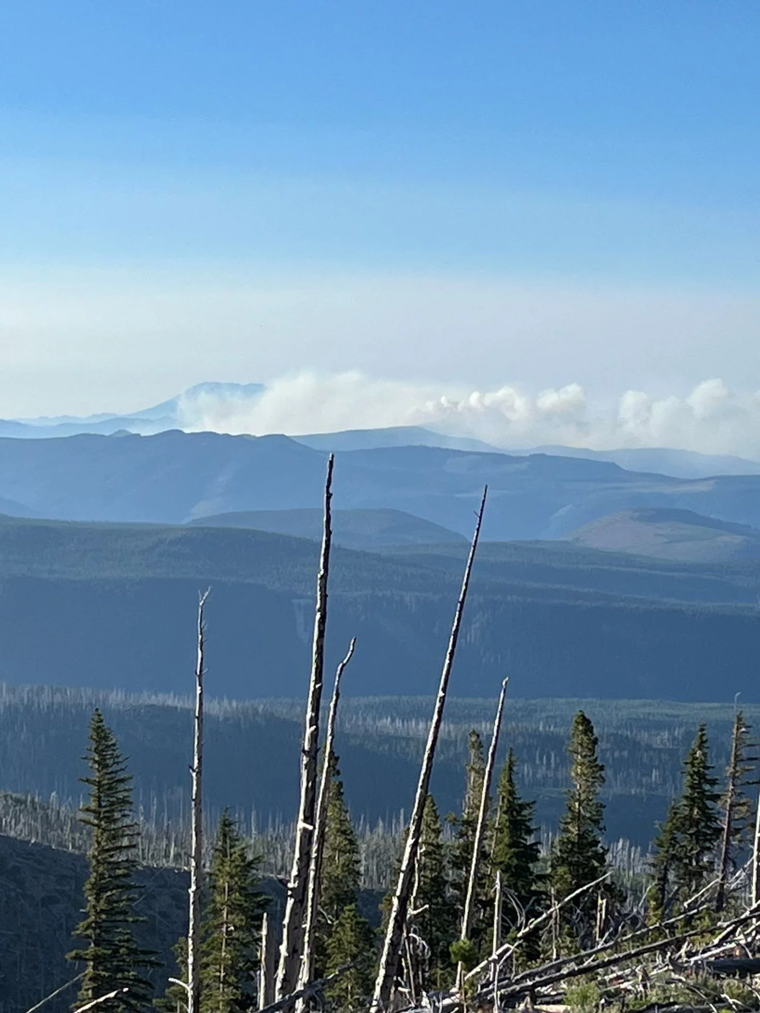
Whisky Creek Fire, August 5, 2024
7. Upper Herman Creek
2024 status
The Whisky Creek Fire ignited on July 20, 2024 and has now burned through the remaining old growth along this hike. The fire is still active as of August 20, 2024. The condition of the old trees and the western recedar grove are unknown at this time. The area is closed to public acess and is likely to be closed for many years.
Historical information only:
Summary
Length 5 miles one way
Difficulty Difficult
Season Summer – early autumn
Elevation range 2,850 feet – 4,420 feet
Human imprint Minimal
Information Mt. Hood National Forest, Hood River Ranger District
Primary old growth features
Classic low-elevation old growth; beautiful western redcedar grove.
Description
The remnants of a classic old-growth grove stand protectively nestled in the palm of the East Fork Herman Creek basin, though the lower mile severely burned in the Eagle Creek Fire (2017). The best route to visit the grove is now via the Rainy Lake trailhead. First, ascend from Rainy Lake for about a mile on an old road known as the Rainy-Wahtum Trail (409), until reaching a major trail junction at the ridgeline saddle. Take the Herman Creek Cutoff Trail (410) straight ahead and start the steep descent on a series of long switchbacks. The lower portion of this trail passes through numerous wet, seepy areas and a collection of colossal conifers up to five and six feet thick near the junction with the Herman Creek Trail (406).
Majestic old growth straddles the Herman Creek Trail in both directions. Turn left to visit an impressive grove of old, shreddy-barked redcedars capable of tolerating the relatively high level of soil moisture in this area. The trail leaves the elders shortly after passing Noble Camp and enters younger forest. Alternatively, turn right at the trail junction and head downstream through gorgeous lowland Douglas-fir old growth for another mile or so.
Another option is to make a long loop by continuing upstream past Noble Camp, climbing through younger forest for two miles. Then turn left onto the Anthill Trail (406-B). In less than a half mile, turn left again back onto the Rainy-Wahtum Trail (409). Follow this mostly-level trail past several panoramic viewpoints back to the junction at the saddle and down to Rainy Lake.
25 Years of Change
The Eagle Creek Fire (2017) severely burned this grove below Whisky Creek, and now the Whisky Creek Fire (2024) has burned the remainder of the grove.
How to get there
Head south through the town of Hood River (55 miles east of the 1-84/1-205 junction) on 13th Street and follow signs towards Odell. Cross Hood River after 4-3/4 miles, then bear right towards Dee. At a junction 6-1/4 miles later bear right towards Lost Lake Campground. Cross the bridge and turn right on Punchbowl Road towards Rainy Lake and FR 2820. FR 2820 turns to gravel 1-1/2 miles later. Proceed up the gravel road for 10-3/4 miles, continuing past the parking area for the Mt. Defiance trail to the Rainy Lake parking area one mile later.
For historical purposes only:
