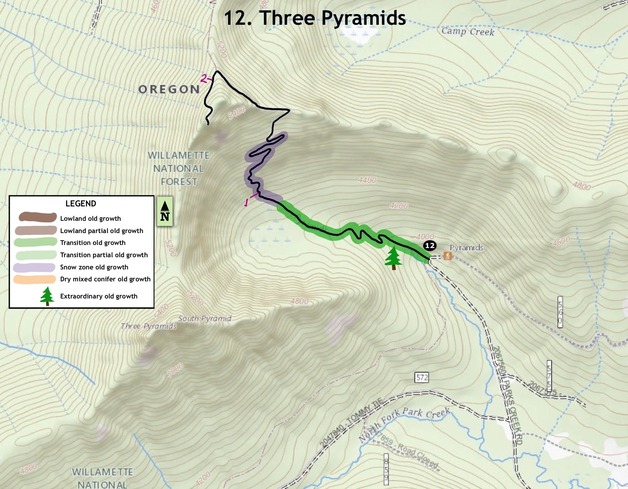
12. Three Pyramids
Summary
Length – 2.2 miles one way
Difficulty – Difficult
Season – Summer to Autumn
Elevation range –3,940 feet – 5,618 feet
Human imprint –Low (mountain bikers)
Information - Willamette National Forest, Sweet Home Ranger District
Primary old growth feature
Noteworthy noble fir forest.
Description
This diverse hike switchbacks up through a fine stand of noble fir old growth on the way to the scenic summit of Middle Pyramid. Together with sister pyramids on both flanks, the Three Pyramids dominate the eastern boundary of the Pyramid Creek watershed. The Pyramids Trail links with several other trails to form a 28-mile loop around the upper Middle Santiam watershed, known as the Old Cascade Crest Loop.
Start off on the Pyramids Trail (3380), bearing right at a junction with the South Pyramid Creek Trail (3403) just after crossing the stream. The Pyramids Trail immediately enters a stately grove of mixed noble fir and Douglas-fir old growth, trending towards cold-hardy true firs as the trail quickly gains elevation. The long, seemingly taper-free noble fir trunks stretch skyward to impressive heights lending a strong vertical feel to the stand. The trail briefly nears a couple of small waterfalls before crossing the stream and entering a brushy meadow dotted with small patches of large noble fir (up to 5 feet thick) and a few big Engelmann spruce.
Resume your ascent up a steep basin sidewall through scattered patches of old noble fir trending to mountain hemlock as you gain elevation. The slopes become increasingly rocky as the trail reaches the crest of a secondary ridge about 1.5 miles from the trailhead. Head west along the north face of this ridge reaching a trail junction with the North Pyramid Trail (4161) a third of a mile or so later passing through a moist flower garden with gorgeous blue gentian.
Turn left heading towards Middle Pyramid on the west slope of the main ridge, and climb the final switchbacks up to the ridgeline for a grand view. Follow the remnants of a path to the right to reach the old lookout site. Old Cascade peaks born during an ancient period of volcanism 18 to 40 million years ago stretch across the skyline to the north, south and west; while younger (3 to 8 million years old) and much taller New Cascade peaks from Mt. Adams to Diamond Peak poke out of the plateau to the east.
25 years of change
More snags; more mountain bike usage.
How to get there
Turn north onto the Lava Lake Road (Forest Road 2067) from U.S. Highway 20 approximately 42 miles east of Sweet Home (just over a half mile west of the junction with State Route 126.) Stay on the main road for 5.6 miles and turn left onto FR 560. The road ends at the trailhead 3.6 miles later. This spot can also be reached from SR 22 approximately 26 miles southeast of Detroit by turning west onto the Lava Lake Road, then turning right onto FR 560 approximately 2 miles later.

Noble fir

Noble fir

Blue gentians

Mt Hood
