2. Larch Mountain Basin
2024 Status
Based on recent aerial photography and fire severity maps, the old forest along this hike appears to be in good shape. I plan to update the hike description and map later in 2024 after re-hiking the loop.
Summary
Length 6 miles
Difficulty Moderate
Season Late spring to autumn
Elevation range 2,790 feet - 3,960 feet
Human imprint High (high visitor use at the top, hikers and mountain bikers)
Information Columbia Gorge National Scenic Area
Primary old growth features
Extensive stand of Douglas-fir, western hemlock and noble fir old growth close to Portland.
Description
An extensive and well-trailed patch of old growth lies sheltered in the crater of Larch Mountain, a misnamed but popular destination less than 40 miles from Portland. Early lumbermen from the Lake States marketed the noble fir found near the mountaintop as larch because of the high quality of the noble fir wood, and it's been called Larch Mountain ever since. Although the mountain receives heavy use on weekends, most visitors drive to the top for the view and leave the trails to the more energetic. A 6-mile loop allows relatively easy exploration of the old forest in the heart of the basin, and links to other hiking options. The loop is also well-used by mountain bikers.
Head counterclockwise down the Larch Mountain Trail (441) from the main parking lot, coming to a small patch of large western hemlock and noble fir a mile or so down the trail. Cross over the ridge onto east-facing slopes and continue downhill across a gravel road until reaching the Multnomah Creek Way Trail (444). The Larch Mountain Trail continues downhill to Multnomah Falls, quickly entering severely burned forest from the Eagle Creek Fire (2017).
Turn right (southeast) on the Multnomah Creek Way Trail (444). Stay right on the Multnomah Creek Way at the junction with the Multnomah Spur Trail (446) a quarter mile later. Start the climb back uphill through a beautiful, open stand of Douglas-fir, western hemlock, and occasional noble fir. The largest of these giants approach 6 feet in diameter. The trail skirts the marshy remains of a post-glacial lake and continues uphill through old forest until crossing a secondary ridge and joining an old logging road in younger forest. The Multnomah Creek Way ends at a junction with the Oneonta Trail (424) on the main ridgeline. Turn right and follow the Onenota Trail back to Larch Mountain Road. The parking lot is another half mile up the highway.
25 Years of Change
Plan to rehike in 2024.
How to get there
Turn off Interstate 84 (Corbett exit 22) 13 miles east of the I-84/I-205 junction and head uphill toward Corbett. Turn left onto the Columbia Gorge Highway after 1 ½ miles, and then turn right onto the paved Larch Mountain Road after another 1 ¾ miles. Park in the large lot at the top of Larch Mountain 14 miles later. (Note: the Larch Mountain Road was closed for several months during 2023, but was reopened prior to the winter closure.)
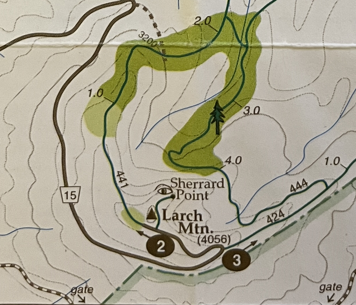
Map note
This map was created in 1993 and was accurate at that time, but has not been field-checked since then. I plan to field check and update the map in 2024.