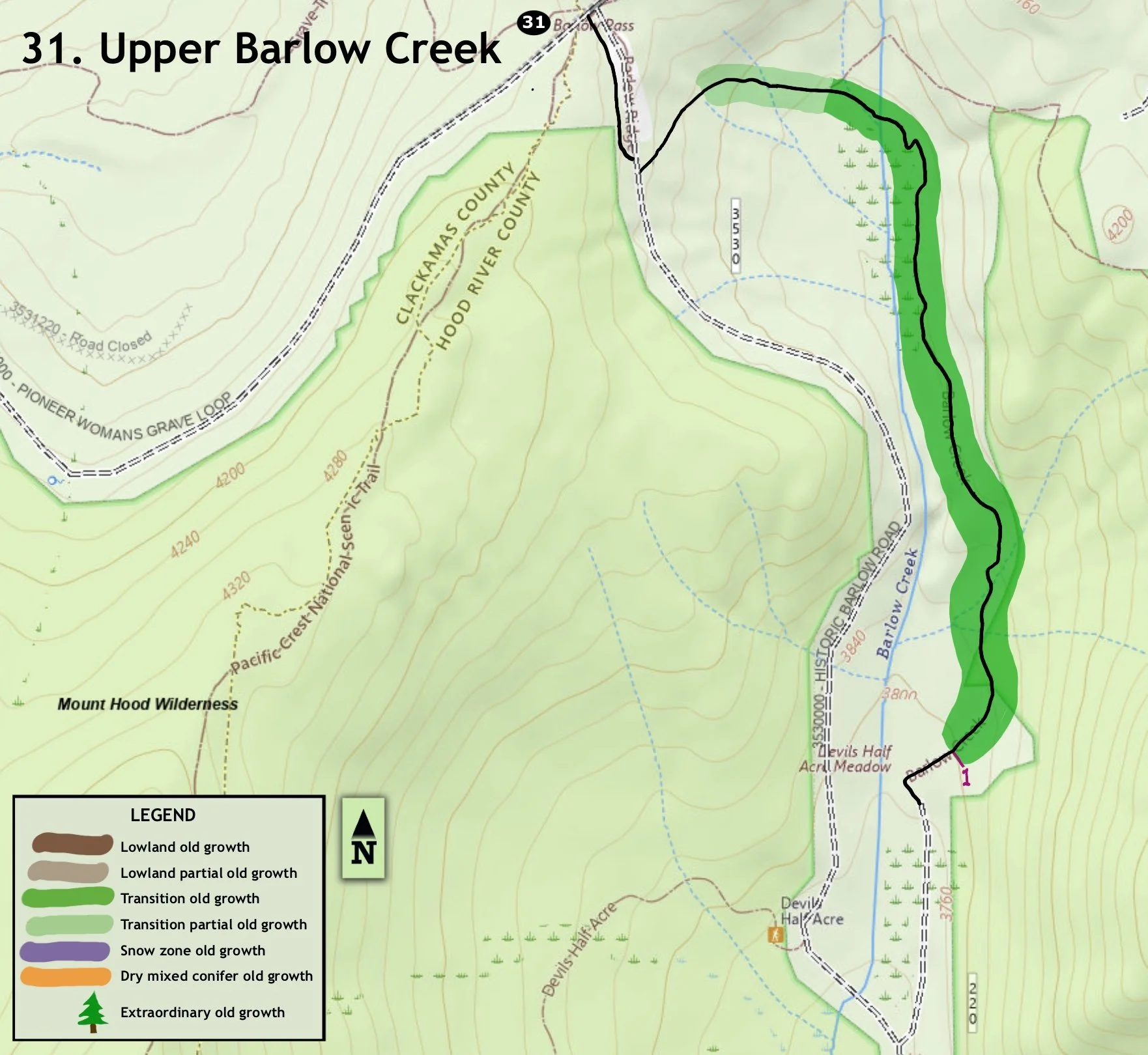
31. Upper Barlow Creek
Summary
Length 1 mile one way
Difficulty Easy
Season Summer - autumn
Elevation range 3,750 – 4,170 feet
Human imprint Low
Information Mount Hood National Forest (Hood River Ranger District)
Primary old growth features
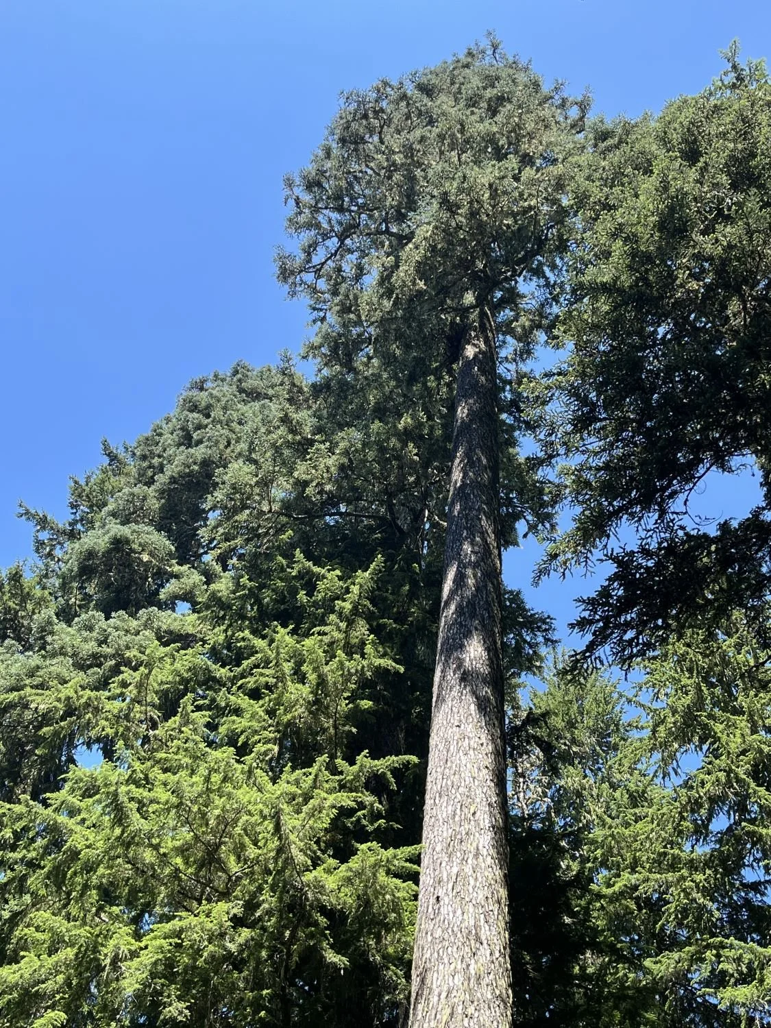
Exceptionally large Pacific silver fir and very old Douglas-fir.
Description
Upper Barlow Creek offers hikers a short and easy old-growth outing, including notably old and large Douglas-fir and Pacific silver fir. The path also follows portions of the original, historic Barlow Wagon Road and ends in a beautiful meadow in full bloom mid-summer. Early-season hikers will need to step through or around numerous seeps and small streams converging in this area.
From the Barlow Pass parking lot, head southeast on a wide path signed as “Barlow Road Wagon Trail,” immediately crossing the Pacific Crest Trail. Continue for a few hundred yards, cross FR 3530, and head steeply downhill on Devil’s Half Acre Trail (482A), though the signage is geared for Nordic skiing. Huge Douglas-fir and Pacific silver fir soon appear.
Stay right at the junction with Barlow Butte Trail (670) where the trail turns south paralleling upper Barlow Creek. Continue downhill along the creek until reaching Devil’s Half Acre Campground, a lightly used dispersed campsite. Along the way the trail passes a pair of giant Pacific silver fir and large Douglas-fir. Old western redcedar, western hemlock and noble fir add diversity and beauty to the forest. Signs along the trail are marked as “Original Wagon Route.”
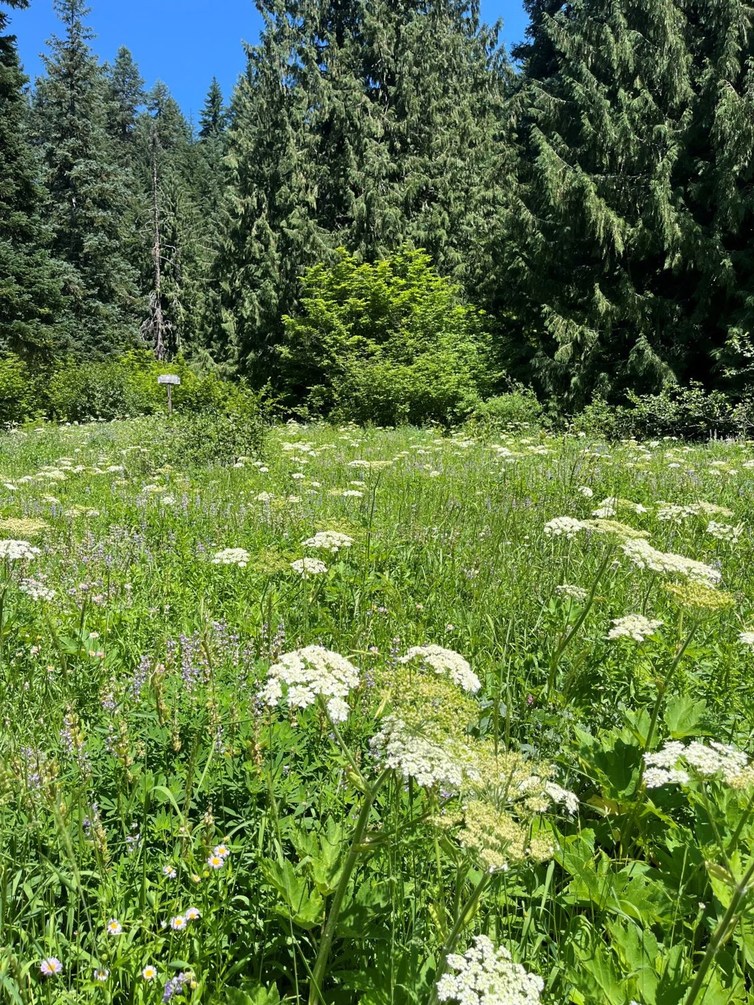
The forest becomes progressively younger and the old forest ends altogether at a gorgeous meadow by the campground. Hikers can turn back from the meadow, or continue through the campground and turn right on FR 3530 to return to the trailhead.
30 Years of Change
The forest appears very little changed. Devil’s Half Acre Campground is now a dispersed camping site.
How to get there
Turn right onto FR 3531 from Highway 35 approximately 2 ½ miles east of the Highway 26/Highway 35 junction. Barlow Pass trailhead parking is on the right a quarter mile down FR 3531.
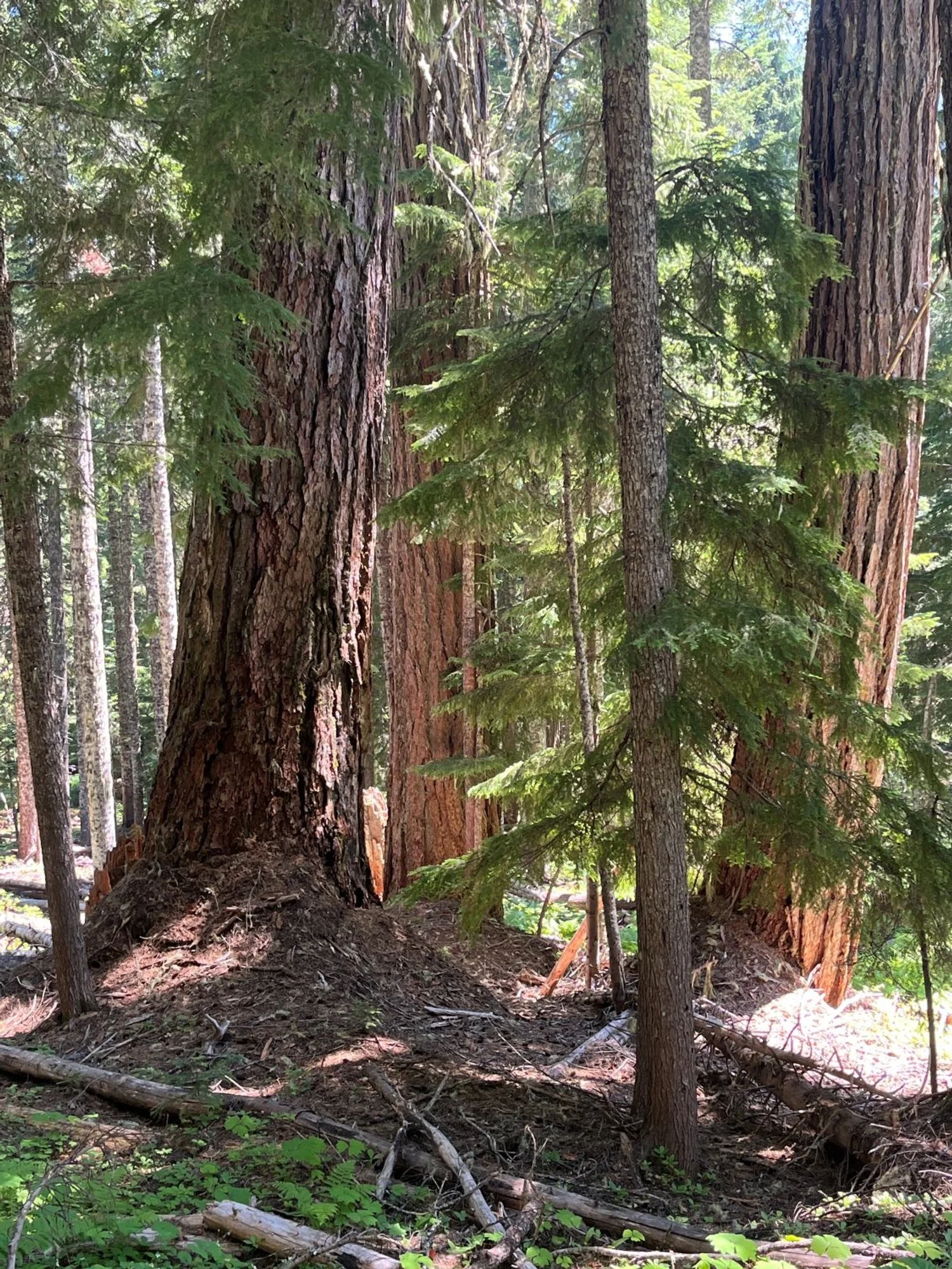
Enormous Pacific silver fir
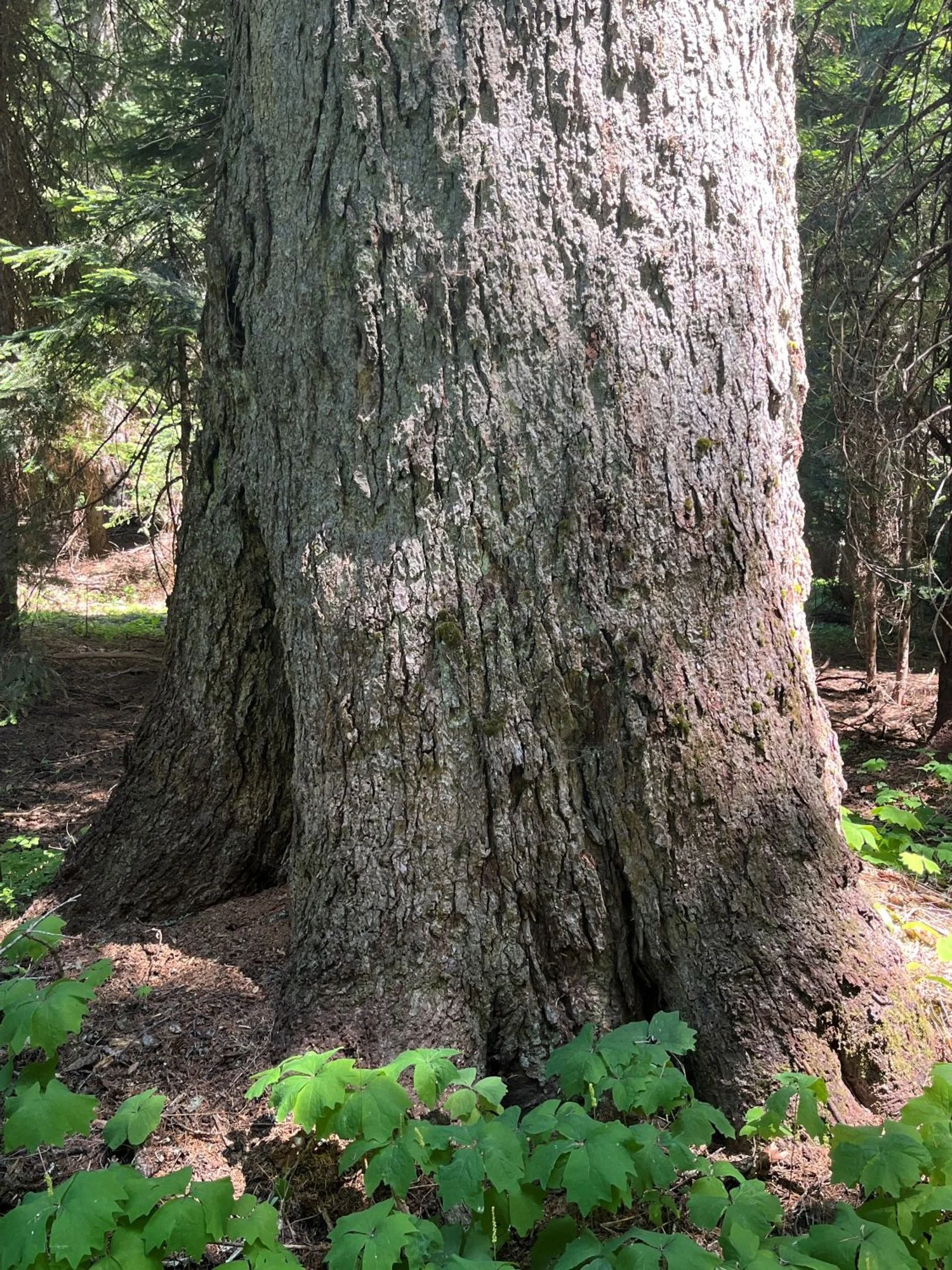
Ancient Douglas-fir with deep duff-mounds

Devils Half Acre meadow
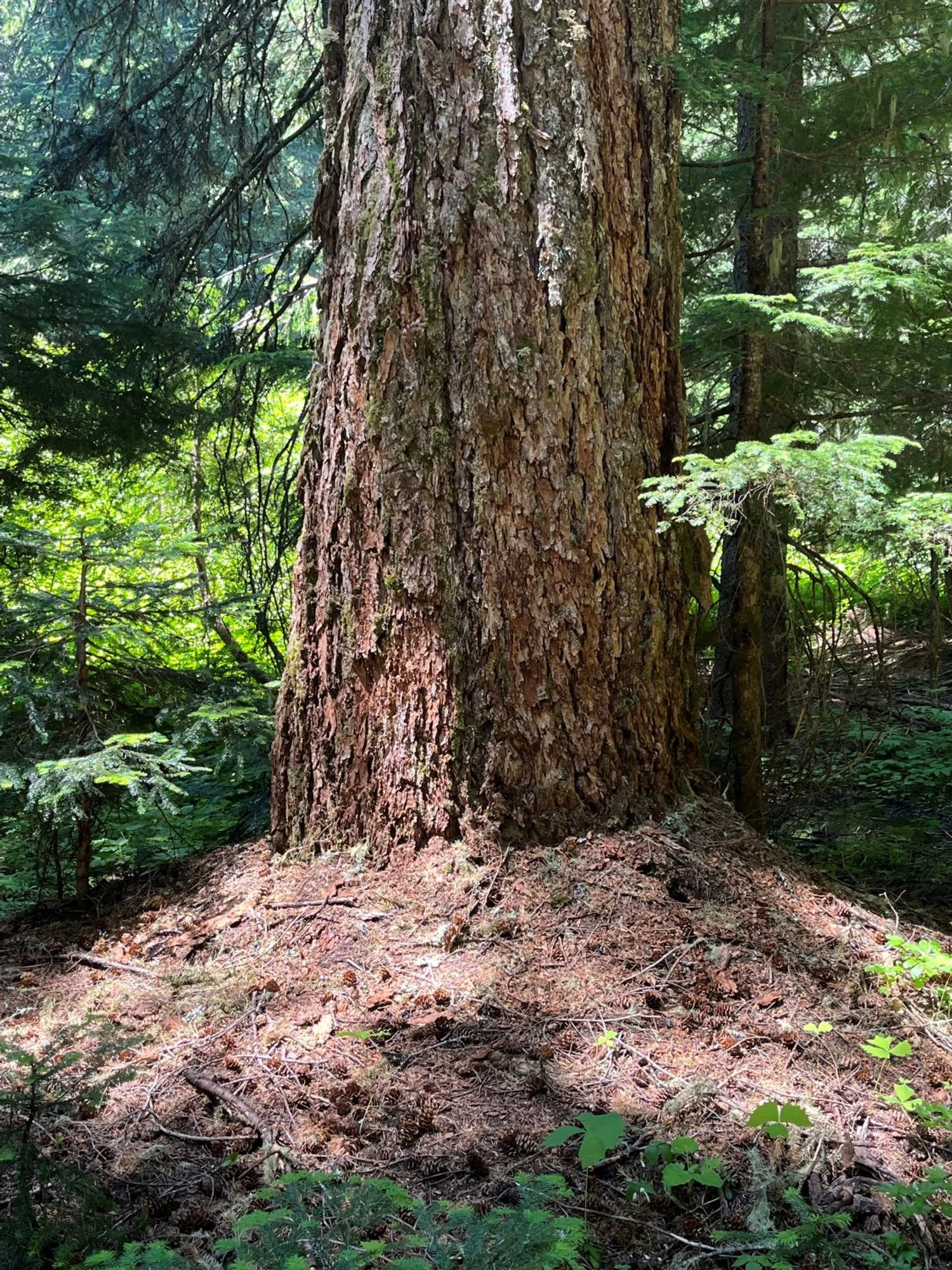
Old Douglas-fir with a duff skirt
Impressive noble fir